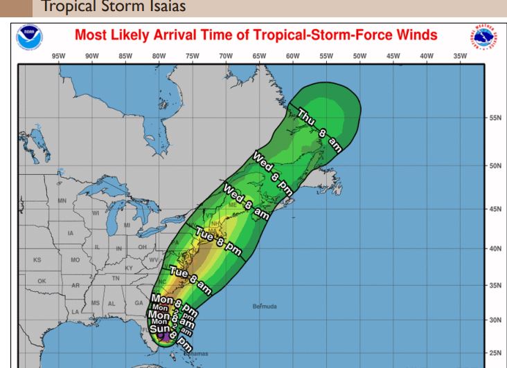
The most likely time of the arrival of Tropical Storm Isaias is Tuesaday August 4th. Expect high winds for areas near and southeast of the I-95 corridor.
However, our area could see Tropical Storm Force Winds as early as Tuesday morning. The primary concern remains heavy rain leading to flash flooding. Some river flooding is possible, but flooding is not expected along
the main stem of the Delaware River.
This morning according to the National Weather Service, Tropical storm conditions (sustained winds of 39 to 73 mph) are possible, primarily for coastal locations and the adjacent waters, Tuesday into Tuesday night along the Jersey Shore.
Expect Coastal flooding around the time of high tides on Tuesday at 9:21 am and 9:36 PM. Expect beach erosion and minor to moderate flooding.
Move your cars to higher ground if you live on the west side near the bay. Move or tie down deck chairs, trash cans and anything that might blow away.