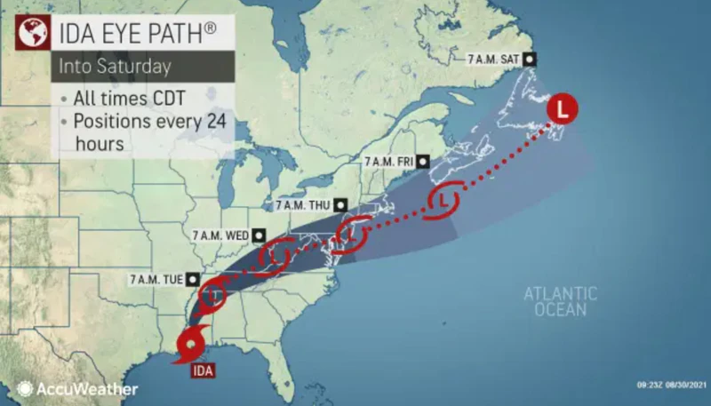

As Hurricane Ida slammed into Louisiana and Mississippi on Sunday, forecasters expected it to weaken as it travels across the Midwest and turns east before reaching New Jersey sometime late Tuesday. But severe flooding and extreme showers remain likely for the NJ Shore.
“Heavy rainfall from Hurricane Ida will affect the Mid-Atlantic region Wednesday and Wednesday night,” the National Weather Service Mount Holly bureau stated Sunday via Twitter. “Minor to moderate river flooding is possible.”
Private meteorologist Steven DiMartino, who runs NY NJ PA Weather, predicted the remnants of Ida would begin to hit Shore communities late Tuesday.
“Clouds will begin to increase as the remnants of Ida make their approach to the region. Showers are possible during the overnight hours,” he stated online about the Tuesday impact.
For Wednesday he predicted, “the remnants of Ida will be over the region and will have periods of rain that will be heavy at times. Flash flooding will be a threat. Winds will be from the northeast at 15-25 mph with gusts up to 40 mph possible. Total rainfall accumulations of 2″-6″ are expected.”