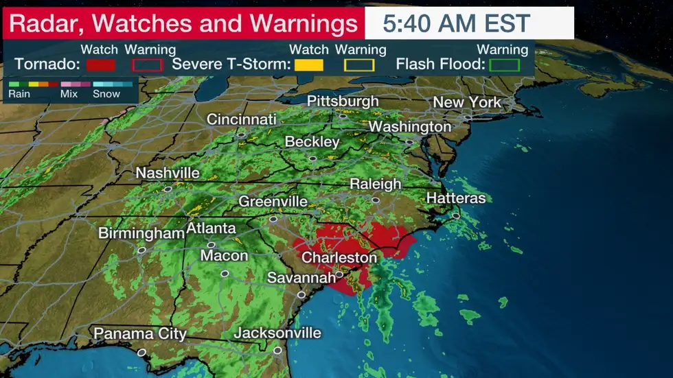
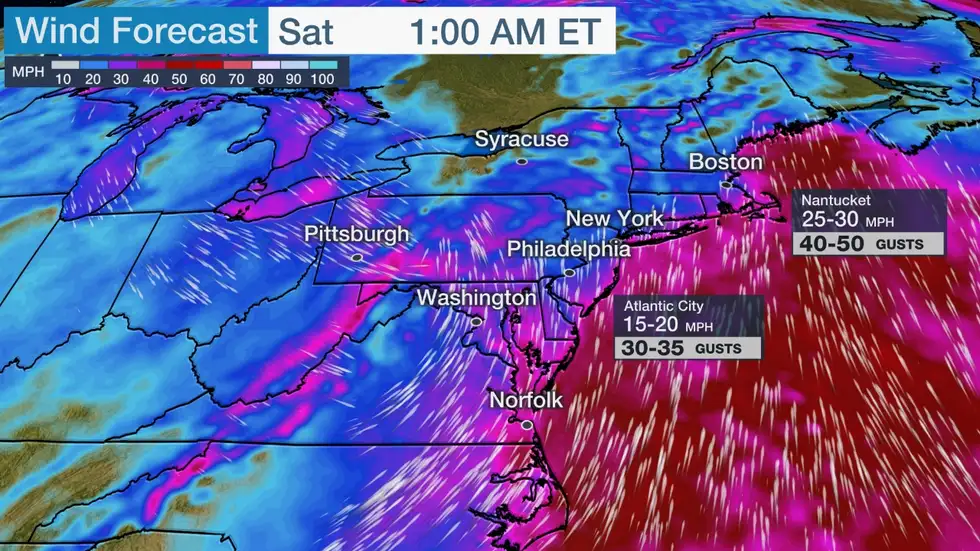
According to The Weather Channel.com the remnants of Nicole will team up with a cold front in the East to produce soaking rain, gusty winds and a few tornadoes into Saturday morning.
Early Thursday morning, Nicole became just the fourth November hurricane to landfall in the mainland U.S. in records dating to the mid-19th century, and the first to do so in 37 years.
Nicole remains a tropical depression that’s centered over Georgia right now. It’s producing a widespread area of rain from the Southeast into parts of the upper Ohio Valley, Appalachians and mid-Atlantic.
This area of rainfall will spread across the Northeast later Friday into Friday night as Nicole’s remnants get absorbed by an approaching cold front.
Rainfall totals could be 1 to 3 inches from portions of the Appalachians into the Northeast through Saturday morning.
Nicole’s remnant in combination with incoming stronger jet-stream energy could produce a few strong wind gusts Friday night into Saturday morning in the Northeast, from the Delmarva Peninsula and Chesapeake Bay north to New England, particularly near the coast.
These wind gusts could lead to isolated tree damage and power outages.
As with most tropical systems, some isolated tornadoes and damaging thunderstorm wind gusts are also possible in Nicole’s rainbands on Friday. Areas from the central and eastern Carolinas into the mid-Atlantic states have the greatest chance of seeing those possible threats.
Nicole was the first November hurricane landfall in the mainland U.S. in 37 years.


Info by theweatherchannel.com

